The Map Location drop zone is used to define the geographic locations required in a map visual. Add at least one geospatial hierarchy to Map Location, or add latitude and longitude measures.
When working with shape maps, you'll see the Map Shape zone instead of the Map Location zone.
A hierarchy that has been assigned to the geocode category can be added to the Map Location zone.
Geocoding
Geocoded maps convert location descriptions (like the name of a country, state, or city) into a location on the map. If your data model contains hierarchies comprised of geolocations descriptions, those hierarchies can be added to the Map Location zone; they are then geocoded to display bubbles on the corresponding locations on the map.
Simply add the hierarchy to the Map Location zone; Pyramid will automatically recognize it as a geocode hierarchy, and display the locations on the map.
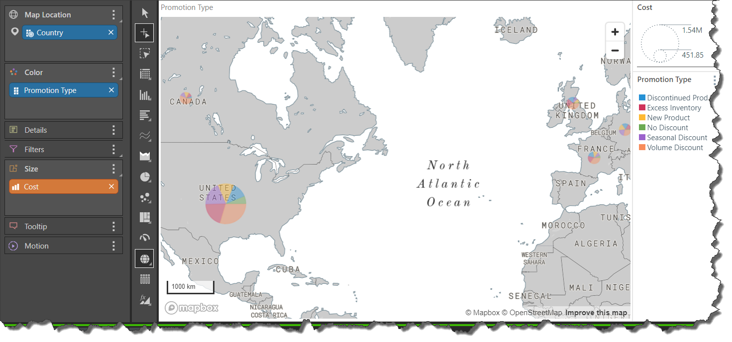
Example
In the example below, the County hierarchy was added to Map Location; each country is represented with a bubble. The Cost measure was added to Size, so that cost is driving the size of each bubble. The Promotion Type hierarchy was then added to Color, splitting each bubble into a pie with each segment representing a promotion category.
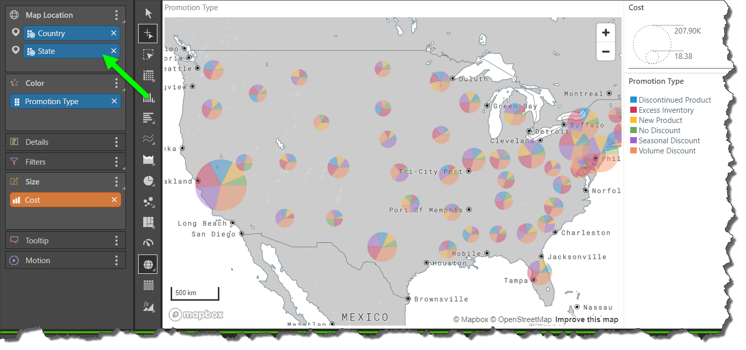
Multiple Hierarchies
Country lineage is supported by adding multiple geocode hierarchies in logical order to the Map Location zone.
In this example, the State hierarchy was placed underneath the Country hierarchy in the Map Location zone; now, states are represented for each country:
If you add a hierarchy that has a lower level than Country, the Set Missing Geospatial Information dialog will appear, where you'll have the option to define a parent country and state.
Latitude and Longitude Coordinates
If your data model contains longitude and latitude measures, you can add these to the Map Location zone to generate a map based on latitude and longitude, rather than geocode locations.
In this scenario, a hierarchy containing unique identifiers should also be added to the query; this will determine which areas of the map will display the latitude/ longitude measures. Depending on your data source, unique identifiers may be a country column, containing specified location within a country (like addresses within the United States), or they might be numeric IDs that correspond to specific latitude/ longitude coordinates, for instance.
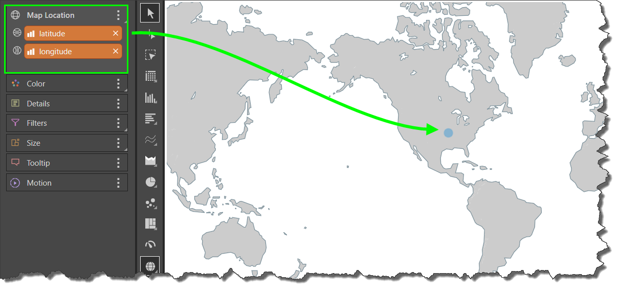
Example
In this example, the latitude and longitude measures were added to Map Location; because these are aggregate measures, only a single aggregate coordinate is mapped:
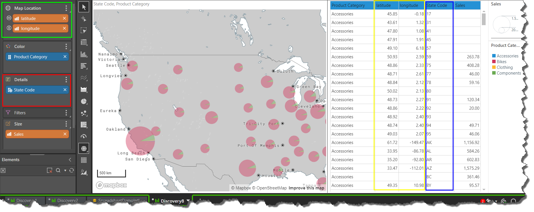
In order to populate the map with latitude and longitude date, the State Code hierarchy was added to the Details zone (red highlight below). In the data grid on the right, we can see that each row in the State Code column (blue highlight) corresponds to a specific latitude and longitude (yellow highlight). The corresponding coordinates are therefore mapped accordingly.
The size of each bubble is driven by the Sales measure in the Size zone, while the Product Category hierarchy in Color splits each bubble into a pie.
Only bubble and geo heat maps enable latitude and longitude hierarchies in the Map Location zone; shape maps support geocode hierarchies only.
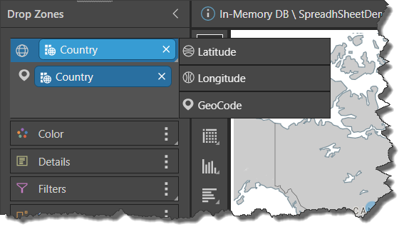
Map Location Submenu
Open the Map Location submenu to expose the sub-drop zones: latitude, longitude, and geocode. Pyramid automatically detects if a chip is latitude, longitude, or geocode, but you can switch them around from this submenu if required.